
Algorithms for calculating the distance from the train to the ahead landmark using satellite navigation
Keywords:
GNSS, I-ATP, intermittent automatic train protection, navigation, satellite navigation.Abstract
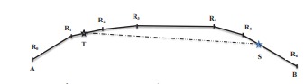
To calculate the distance from the train to the ahead landmark using satellite navigation, the study developed a two-step process for deploying the solution, suggesting the use of Ublox’s GNSS device to acquire positioning information. The article introduces the basic formulas for calculating the shortest distance, calculating a point by knowing two points, and computing the midpoint of two points on the surface of the earth. The route-map for calculating the distance is based on the following algorithms: finding the nearest segment, finding the nearest point, removing the excess point, and averaging the measurements.
Classification number
2.2
Downloads
Published
2018-08-25
Received: 11 February 2019; accepted: 25 April 2019
How to Cite
Le, H. M., Vo, C. M., Nguyen , H. H., & Doan, H. Q. (2018). Algorithms for calculating the distance from the train to the ahead landmark using satellite navigation. Version B of Vietnam Journal of Science and Technology, 61(8). Retrieved from https://b.vjst.vn/index.php/ban_b/article/view/155
Issue
Section
Engineering and Technology



