
Application of satellite images in combination with the hydrological model for the study of flood flow in Ve river basin, Quang Ngai province
Keywords:
Hydrological model, rainfall-runoff, satellite image, Ve river basinAbstract
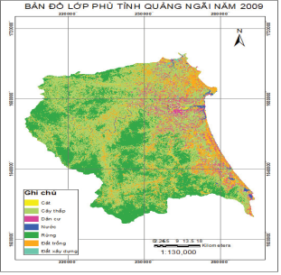
In this paper, the application of satellite images in combination with the hydrological model for the study of flood flow in Ve river basin focused on 2 aspects: 1) Using satellite images to analyze and assess the change of vegetation cover in Ve river basin; 2) Study on the adjustment of parameters of the hydrological model for Ve river basin based on processed data from satellite images. Initial research results showed that satellite images reflect objectively the variability of objects on the surface of the river basin and allow timely updates of these changes to provide a scientific basis for determining the parameters of the hydrological model suitable for the river basin. This good approach should be further developed to improve the technology and accuracy for the hydrological model
Classification number
2.1
Downloads
Published
Received: 9 October 2017; accepted: 11 December 2017



